
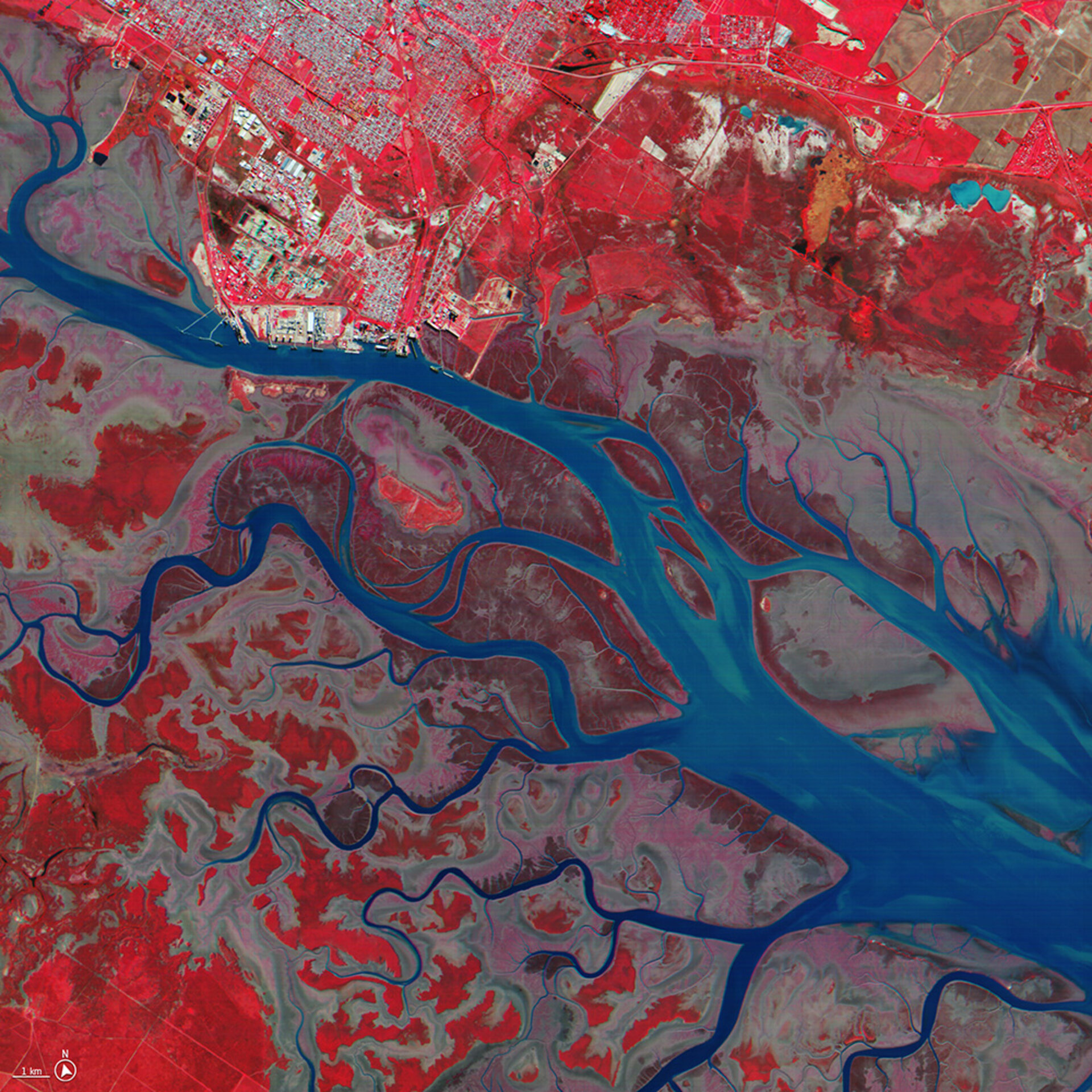
Φsat-2 view of Bahia Blanca Estuary in Argentina
The false-colour infrared composite image combines near-infrared spectral band 7 with red and green bands, 3 and 2, to RGB components directly. Infrared images are most commonly used to assess plant density and health, as plants reflect near infrared and green light, while absorbing red. Since they reflect more near infrared than green, plant-covered land appears deep red. Dense plant growth is darker red. Water appears blue or black.
This combination of bands was chosen for this image to highlight the complex terrain around the riverbanks, which would not be easily discernible in a true-colour image. The water is highlighted with blue and is surrounded by muted red/brownish patches that absorb near infrared because they have high water content. That is because the region Bahia Blanca Estuary in Argentina is a large, coastal wetland and the brownish/muted red areas correspond to marshes. Red indicates the patches of surface covered with vegetation and grassland, both important for migratory birds. The tidal flats appear light grey in this image. The town of Bahia Blanca is shown at upper left.
Read full story: Φsat-2 begins science phase for AI Earth images


